

Introduction
Jamaica became the 69th Member State of the IHO when it acceded to the IHO Convention in April 2000 (following the initiation of the membership process in 1991) and as such a full member of the regional arm of the IHO the Meso-American and Caribbean Hydrographic Commission (MACHC).
Jamaica has a National Hydrographic Committee (NHC), established in 2006 as a Committee of the National Council on Ocean and Coastal Zone Management (NCOCZM), which is a Policy Advisory Council in the ministry of Foreign Affairs and Foreign Trade. Membership on the Committee is drawn from key maritime interest groups, and other stakeholders, including: the National Land Agency (NLA), Jamaica Defence Force Coast Guard (JDFCG), Port Authority of Jamaica (PAJ), Maritime Authority of Jamaica (MAJ), Caribbean Maritime University (CMU), Ministry of Foreign Affairs and Foreign Trade (MFA&FT), The University of Technology (UTECH) and the Centre for Marine Sciences at the University of the West Indies (UWI). The terms of reference for the National Hydrographic Commission (NHC) were developed based on a framework provided by the International Hydrographic Bureau of the IHO.
The National Land Agency (NLA), given its mandate for hydrographic surveying at the national level is deemed to be the National Hydrographic Office and is the IHO focal point for Jamaica.
The Hydrographic team is a part of the Surveys and Mapping Division and is currently staffed by 5 team members.The team consists of two Category-A and one Category-B hydrographic professionals who have received international training and are certified by the International Federation of Surveyors (FIG), International Hydrographic Organization (IHO), and International Cartographic Association (ICA).
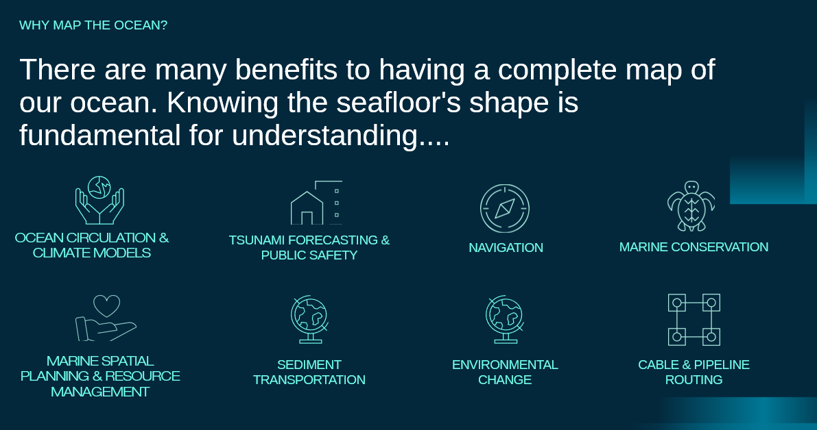
Benefits of the Hydrographic Surveys
Articles and Features
Feature Article: National Land Agency advancing blue economy through Hydrography Programme

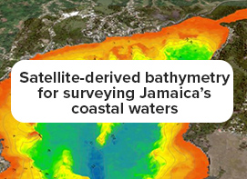
NLA and TCarta Joint Article: Satellite-derived bathymetry for surveying Jamaica’s coastal waters
- Video: Click this link to view: Seabed 2030: The Mission and the Call
- Video: Click this link to view: The Multibeam Demo
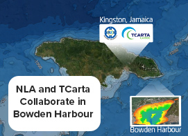
NLA and TCarta Collaborate in Bowden Harbour, Jamaica: This was the first deployment of the satellite-derived bathymetry in Jamaica.
Click here or the image to view the storyboard.
Workshops
Land Registration and Conveyancing Workshop starts May 14, 2024
Social Links
Live Chat Count Down
Contacts
For general information about our services, please contact us at:
- asknla@nla.gov.jm
- +876.750.5263
- +876.946.5263
- 8 Ardenne Road Kingston 10